
A team of robotic experts from University of Waterloo has developed a system that allows a UAV to land on an autonomous land vehicle in motion. This technology could have military applications, but not only…
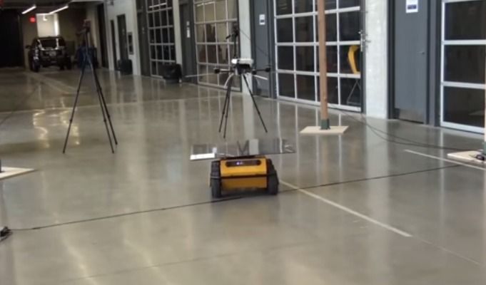
Operating a drone from an autonomous land vehicle would offer many advantages in field operations. The vehicle could carry a drone and transport it to a remote area where it would perform reconnaissance missions and then come back to vehicle for recharging its battery. An alternative option would be to land a drone on power lines. In the first case, it is important that the two devices coordinate so that the UAV can land on the vehicle, including when the latter is in motion. This is exactly what has been achieved by robot specialists at the University of Waterloo in Canada. To achieve this, the team at Wave Lab has developed a procedure for coordinated and autonomous control. Each vehicle converges to a set point while communicating with a position control system hosted on a server . This controller will take into account a number of variables that can disrupt the trajectory of gear, such as wind or the latency of a radio signal or WiFi connection. Tests conducted indoor and outdoor demonstrate the feasibility of such a system.
[youtube]https://www.youtube.com/watch?v=JRjJV_WLluA[/youtube]
This research has already been published in the journal of Autonomous Robots. Initially, the application of this technology seems of military nature. Send a car in tandem with a drone to sensitive or inaccessible areas to monitor inaccesible or dangerous areas before intervention. But one can also imagine that this configuration can also be used in space exploration of planets or asteroids. And why not, environmental missions where ground vehicle would dock and regularly regularly collect data by the drone? Scientists would have a real-time monitoring and could move their device to suit their needs for collecting the data on the ground or in the air.